Lindy Point and the Frost-Heaved Ground
Blackwater Falls draws most people for the falls themselves, the amber river pouring over a five-story ledge, stained dark by the tannins of hemlock and red spruce upstream. But Blackwater Falls State Park holds more than the falls, and on a clear, cold afternoon in late March I went out for one of its quieter corners instead, the overlook at Lindy Point.
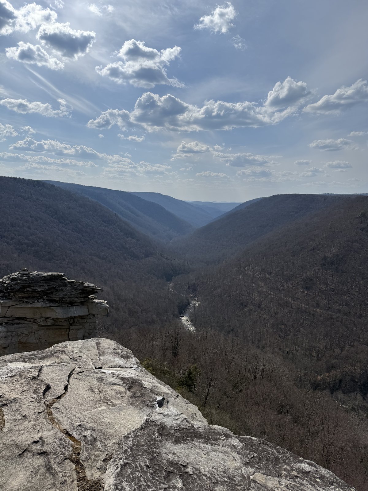
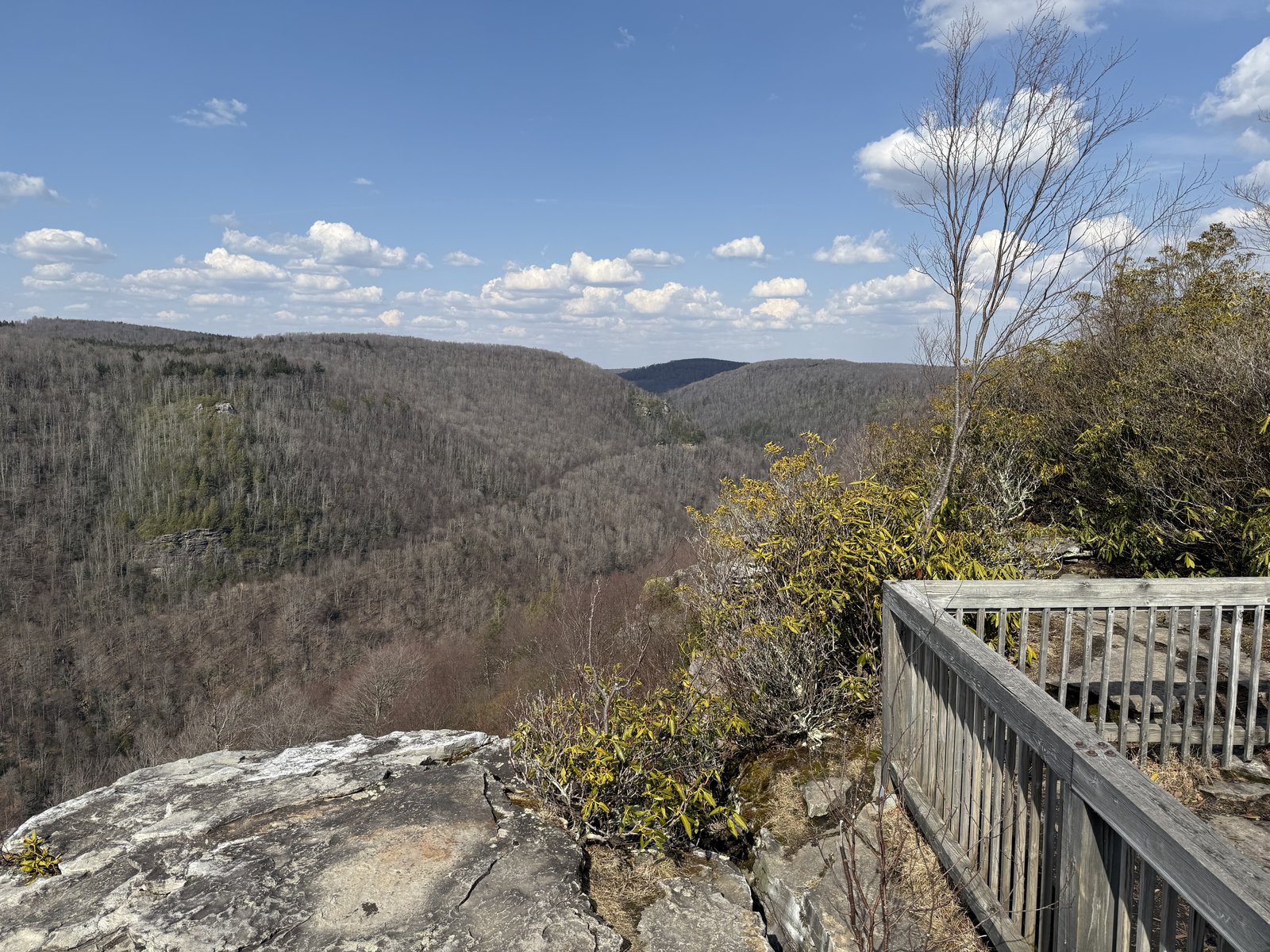
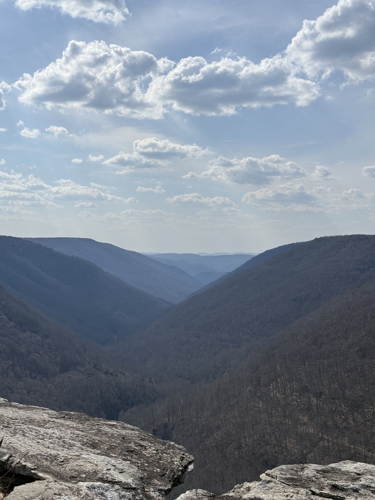
The Lindy Point trail is a short and easy one, a little under a mile round trip and nearly flat, running out from Canaan Loop Road through spruce and rhododendron to a rocky promontory at the rim of the Blackwater Canyon. It is the kind of walk anyone can do, and it pays off all out of proportion to the effort. The trail ends at a railed outcrop where the ground simply falls away, and the canyon opens up below, eight miles of it cut more than five hundred feet deep, running off to the northwest in a long blue V. In March it was all bare hardwood and haze, the river a thread at the bottom, the ridges layering back into the distance. The leaves were still weeks off up here, and the view was wide open because of it.
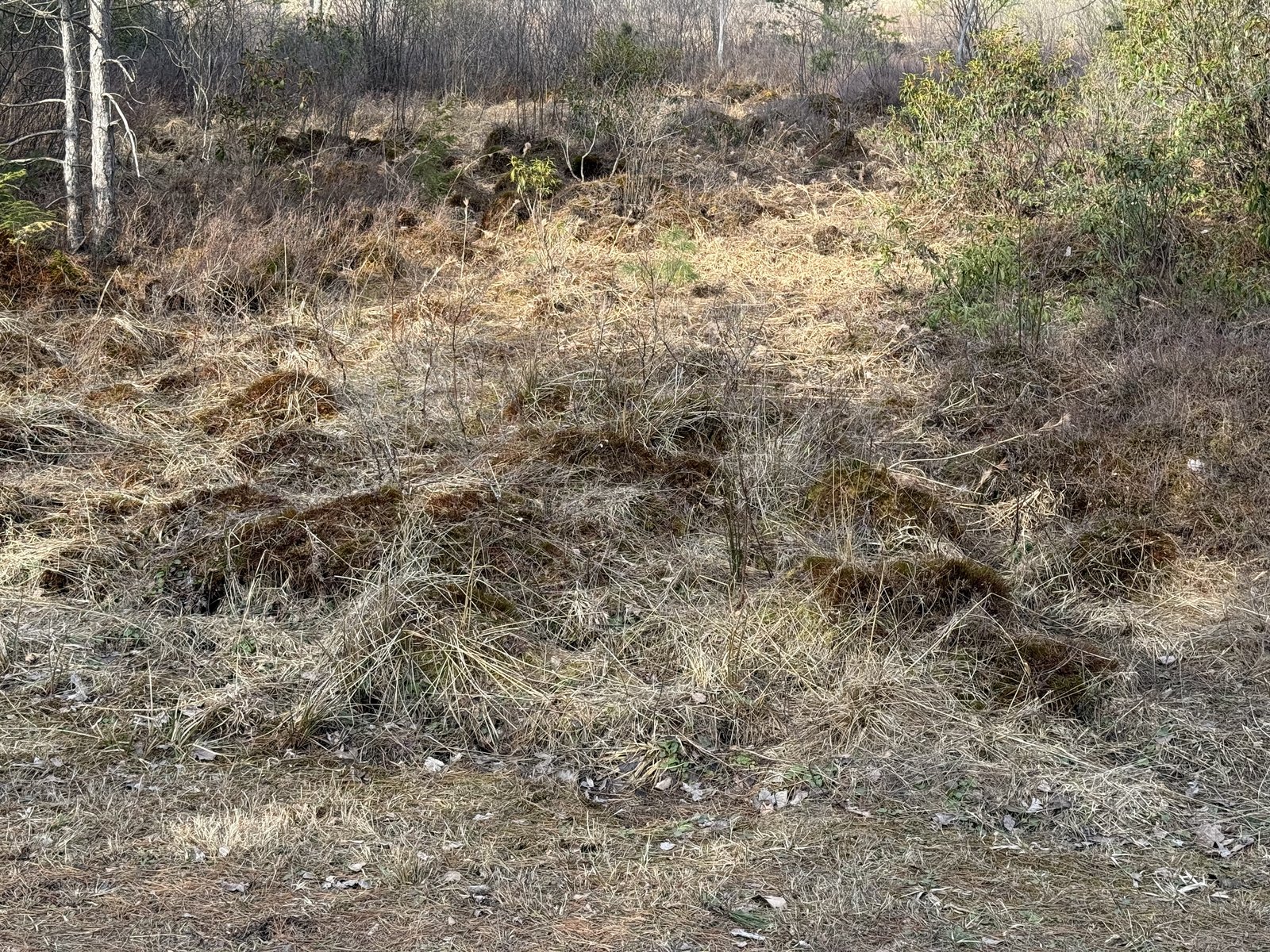
On the walk back I stopped at something easy to overlook right at my feet. A patch of open ground was covered in low hummocks, clumps of grass and soil heaved up into a lumpy, mounded surface, like the ground had been kneaded. This is frost heave, and the hummocks it builds are worth slowing down for. When saturated soil freezes, water in it pulls together into lenses of ice that lift the ground above them, and as the cycle of freezing and thawing repeats through the winter, the soil gets sorted and pushed up into these mounds and tussocks. It is the same process that buckles roads and shoves stones to the surface of a field, working here on a small, slow scale, building hummocks one freeze at a time.
What makes it worth a note is what it says about the place. This kind of hummocky, frost-heaved ground is far more typical of climates well to the north, where winters are long and the ground freezes hard and often. Seeing it here is a reminder that this high plateau, up near 3,200 feet, is one of the coldest, snowiest corners of West Virginia, a little piece of the north pulled down into the central Appalachians. The cold that stains the river and grows the spruce is the same cold that heaves the ground.
Lindy Point is a short walk, and a good one for an easy day. But if you want more underfoot, this is a fine doorway to bigger country. The Allegheny Trail , West Virginia’s long north–south footpath, runs more than three hundred miles through these highlands, and within the park itself there are more than twenty miles of trail to link together. South of here the Spruce Knob–Seneca Rocks National Recreation Area opens into rougher, higher ground, with the longer and more remote routes to match. Lindy Point is a place to stand and look out at all of it before deciding how far you want to go.
All photos are original, taken on this hike.